National Taiwan University
Published on 8 October 2026




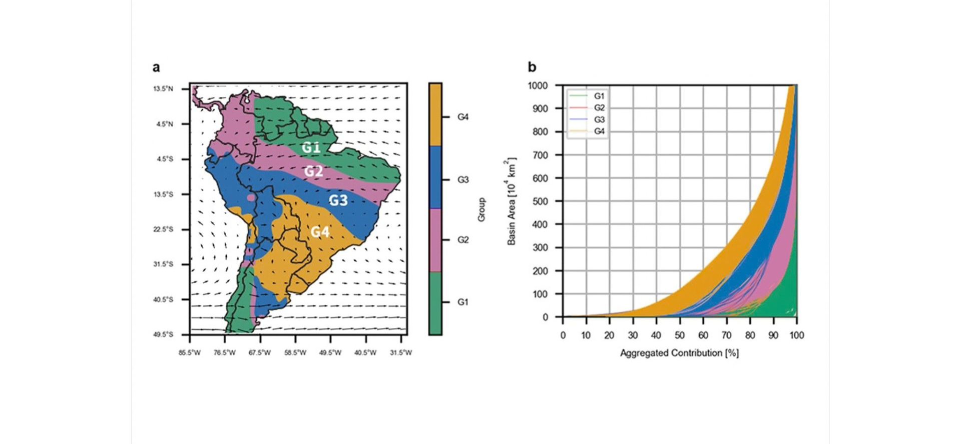
While traditional water resource management fundamentally relies on terrestrial catchments, understanding atmospheric moisture transport is increasingly recognized as a critical scientific imperative. An interdisciplinary team from National Taiwan University (NTU) has successfully mapped the hydrological systems of South America's "flying rivers," publishing their novel findings in Nature Communications. This breakthrough study challenges boundary-centric governance by quantifying how land-use changes thousands of kilometers upwind dictate regional water security.
Led by Dr. Wei Weng, Dr. Kai-Chih Tseng, and Dr. Li-Pen Wang, the NTU researchers pioneered the "moisture drainage curve"—an advanced mathematical framework that objectively identifies critical upwind basins. Moving beyond arbitrary percentage-based metrics of the past, the team successfully conceptualized these aerial rivers into distinct hydrological regimes: headwater, drainage, outfall, and plain areas. This structural stratification accurately delineates the heavy dependencies of terrestrial rainfall on distant forest evapotranspiration.
By dynamically linking atmospheric moisture convergence with terrestrial river systems, NTU provides a robust scientific paradigm for ecological governance. As climate change and deforestation accelerate globally, this novel framework arms policymakers with the empirical evidence needed to integrate distant upwind forest conservation directly into localized, cross-border water security protocols.